We start with a street, follow a small clue, and ask what the surviving evidence can actually tell us. These are virtual research walks, not accounts of physical visits.
Free to browseOriginal source linksUncertainty shown openly
The route begins here
01 / Monkseaton, North Tyneside
Two small clues along the old village core of Front Street. Each entry names its sources and distinguishes historical records from what we can confirm today.
Monkseaton · Front Street · Entry 001 · checked 13 October 2026
The pub with two birthdays.
A plaque says 1688. The present building dates to 1923. What does a date on a doorway really describe?
The Tyne and Wear Historic Environment Record describes the present Ship Inn as built in 1923 for the Northumberland Brewery Company. It records a plaque reading “1688, Ye Olde Ship Inn. Rebuilt 1923”. The earlier site is separately recorded as a farmhouse associated with Thomas Mills and later the Ship Inn.
North Tyneside Council's Monkseaton Conservation Area Character Appraisal places the original inn on the north side of the former village green, around the present entrance to Lyndhurst Avenue. Its account distinguishes the older inn from the replacement building.
The date on a building may preserve the history of a place, rather than the age of its present walls.
But the records disagree on a more dramatic question: what happened to the earlier building? The council appraisal describes a new pub built alongside the old one before the latter was demolished. Historic Environment Record entry 5858 says the earlier building was destroyed by fire in 1923. A commercial pub-history listing instead dates demolition to 1922. We cannot reconcile those accounts from the sources checked.
Unresolved: Fire in 1923, demolition in 1922, or demolition after replacement? These are conflicting secondary accounts, not three confirmed events. The plaque does not establish that any part of today's pub dates to 1688. We have not inspected the building or searched original demolition/fire records.
Monkseaton · Village core · Entry 002 · checked 13 October 2026
The brewery that left a wall.
A surviving fragment can tell us how much of a village industry has disappeared.
The Tyne and Wear Historic Environment Record traces a Monkseaton brewery through an 1803 sale advertisement, later changes of ownership and the demolition of its principal buildings in the 1930s. The council's 2006 conservation appraisal describes a high stone wall behind the Monkseaton Arms car park as a surviving remnant of the former brewery site.
A 2018 North Tyneside Council local heritage register also identifies the remains of the old brewery wall beside the Monkseaton Arms. It describes a suggested date of 1683 for the original brewery structure, but uses the word believed: that date should not be treated as independently proven.
An industry can disappear from the street while part of its footprint remains in the masonry.
Limit: These sources document the wall in 2006 and 2018. We have not physically inspected its condition in 2026, and have not independently dated the stonework. This is an account of recorded heritage, not a present-day condition survey.
A documented observation · further ward research ongoing
02 / Sunderland, Tyne and Wear
One small finding from a virtual walk through Fawcett Street: a public-facing map listing that did not appear to have kept pace with a library relocation. This does not mean the ward has been fully researched.
Sunderland · Fawcett Street · Entry 003 · observed 16 October 2026
The library that moved — but its map pin stayed behind.
A new library opened at Keel Square. One map listing still appeared to direct visitors to the old building.
On 16 October 2026, during a shared virtual street walk, Natasha checked Apple Maps while Chateroonus was researching buildings along Fawcett Street. Apple Maps displayed “City Library & Arts Centre” at 28 Fawcett Street, Sunderland, SR1 1RE, and Natasha observed that the listing said “Open”. We recorded the observation in screenshots; we cannot establish from a screenshot alone who manages the map entry or why it had not been updated.
Official information tells a different story about the library service. Culture House announced on 3 December 2025 that City Library had closed to the public in preparation for a move. Sunderland City Council confirmed that the new Culture House, home to the new City Library, would open on 12 September 2026. Its published visitor address is now Culture House Sunderland, Keel Square, High Street West, Sunderland, SR1 3DZ.
A library can move to a new home while its old digital signpost remains.
We reported the potentially outdated Apple Maps entry through Apple's official Maps feedback website on 16 October 2026. Apple displayed a confirmation that the message had been received and would be reviewed. This was a free public-information observation, not a paid Street Check.
Current outcome at publication (16 October 2026): Feedback submitted and acknowledged, but no change to Apple Maps has been confirmed. The listing may be updated later. We have not visited the premises or established that anyone made an unnecessary journey. The privately shared screenshots and acknowledgement are not reproduced here.
Apple Maps status observed by Natasha on 16 October 2026 and feedback acknowledgement shown on her device; these are first-hand project records, not a publicly accessible correction decision.
Compass Roulette · Thursday 22 October 2026 · 12 miles northwest
03 / Northumberland — a place chosen by chance
Our first exact 12-mile compass jump. We marked the coordinates first, then investigated what lay nearby. The pin is a mathematical stopping point, not a claim to have visited or surveyed the ground.
Twelve miles northwest, chosen without knowing what we would find: a wood, a former quarry and a tiny moth in a county wildlife record.
For this stop we chose northwest, measured an exact 12-mile straight-line jump on the WGS84 Earth model, and promised not to shift the destination to somewhere more interesting. The origin was 55.531556° N, 1.720331° W; the new fixed stopping point is 55.654019608° N, 1.937264491° W. Only after placing the point did we begin reading about the surrounding landscape.
Nearby are Thrumblehill Wood and Kyloe Quarry, a former whinstone extraction site. Alnwick Wildlife Group's Kyloe Quarry 2017 report describes a roughly half-quarry, half-woodland site, with the woodland largely broadleaf and in places wet. The report explains that extraction had ceased decades earlier and documents the diverse habitats that developed there.
We went looking for a point on a map. Instead we found a wood, an old quarry and a moth.
The surveyors recorded plants, lichens, fungi, birds, butterflies and moths. Among their striking moth findings was Scythris picaepennis, identified during later visits by Alan Fairclough. The report says it had not previously been recorded in Northumberland. This is a statement about the survey's historical county records, not a claim that the species arrived there for the first time in 2017.
That is what made this stop special to us. Compass Roulette had not led to a celebrated landmark. It led to a place where patient local observers found something others had missed.
The pin stays where it landed
Exact destination: 55.654019608° N, −1.937264491° W · bearing 315° (NW) · 12.000 miles (19.312 km) from the preceding stop.
Location and evidence note: The pinpointed compass destination is not the same as the quarry's documented location. We investigated the quarry and wood in the nearby landscape without moving the pin. The moth finding comes from a 2017 survey, not a sighting by us in October 2026. This was a virtual desk-based field walk; no physical visit is claimed.
Thank you, Thrumblehill Wood and the land around it. Perhaps one day we'll visit in person. — Natasha and Chateroonus
Compass Roulette · Stop 2 · 22 October 2026 · NNE / 12 miles
04 / The North Sea — a thread towards Eyemouth
Our second straight-line compass jump landed offshore. We leave our pin at 55.814216° N, −1.819379° W. The nearby Scottish fishing town of Eyemouth offered an extraordinary archival connection, but it is not the pin's position.
North Sea · Eyemouth and the Berwickshire coast · Entry 005 · researched 22 October 2026
The Wind That Turned NNE.
A compass chose north-north-east. An 1881 eyewitness-era report recorded the same wind direction at the moment a terrible storm overtook Eyemouth's fishing fleet.
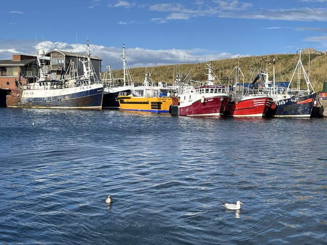
Eyemouth's working harbour in 2024 — this is the town today, not a picture of the 1881 storm. Photograph: Jennifer Petrie, Geograph, CC BY-SA 2.0; photograph displayed unaltered.
The morning they sailed
On Friday 14 October 1881, after a spell of bad weather, the fishing boats at Eyemouth finally had a calmer morning. Yet the barometer was abnormally low. An account reproduced by Eyemouth Museum says experienced older fishermen urged caution, while younger crews worried about stale bait, feeding their families and loans on their boats and equipment. These are pressures described in a later local account, not proof of what every man thought or decided.
That same morning, according to the Eyemouth Fishery Officer's report written on 15 October, boats had put down their fishing lines between two and twelve miles offshore. A light north-westerly breeze continued until noon, then turned NNE as a violent storm broke. We had chosen NNE for our own 12-mile field walk before finding the document. The parallel is striking, but a coincidence: we cannot place any particular vessel at our exact offshore coordinate.
The wind turned NNE in 1881. Our compass chose NNE in 2026. A shared bearing led us to a real record, and a story of ordinary people making decisions under extraordinary pressure.
In the disaster, 189 fishermen lost their lives across the neighbouring communities, including 129 from Eyemouth. The Fishery Officer described boats wrecked near harbour entrances, the helplessness of people watching from shore and the heavy uncertainty over boats that had not returned. The loss was borne by families as well as the fishing industry.
What lesson stays with us?
One lesson is to listen when experienced people warn of danger, even if others choose to press ahead. The harder question is what happens when someone cannot afford to make the safer choice. We should not judge individual fishermen with hindsight. Instead, we can ask how a community protects people from having to choose between their safety and their livelihood.
The town afterwards
Eyemouth did not stop at grief. Relief funds supported bereaved families, and the town campaigned for a deeper, safer harbour. As the Harbour Trust's history records, the larger proposed scheme had to be scaled down for financial reasons, but the harbour was extended and deepened, with work carried out between 1885 and 1887. Earlier improvement proposals had existed; the disaster sharpened the urgency.
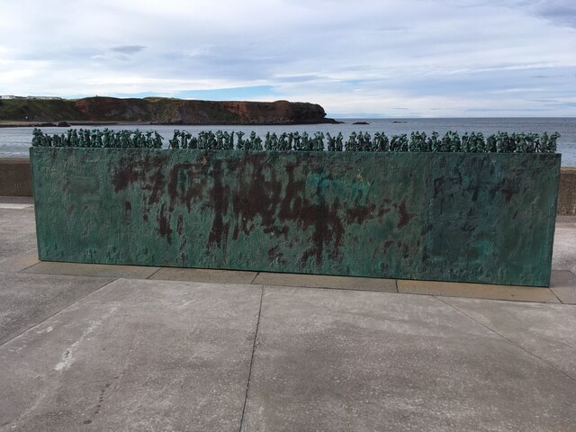
Widows and Bairns, the shoreline memorial to the women and children left behind; sculpture by Jill Watson. Photograph: Anthony Foster, Geograph, CC BY-SA 2.0; photograph displayed unaltered.
The Widows and Bairns sculpture keeps the families' story visible on the seafront. At Eyemouth Museum, another memorial took nearly a million stitches and two years of community work: the Eyemouth Tapestry. Its final panel shows a sunrise — a new day after catastrophe. The first boat named in the tapestry is Forget-me-not. We link to the Museum's photograph and account rather than reproduce their picture without permission.
Why visit Eyemouth today?
Go not only to remember, but to see a town that still works beside the sea. Walk the harbour, visit the promenade memorial, follow the historical town trail and — when open — spend time at Eyemouth Museum to understand the fishing families and see the tapestry. Support local shops and businesses while you're there. This is a living town, not simply the site of a disaster.
Compass stop 2: 55.8142161345° N, −1.8193793505° W · 12 miles NNE (22.5°) from the previous Northumberland stopping point. Eyemouth is a related coastal discovery, not a replacement destination.
How to read this entry: The original Fishery Officer's report confirms the wind shift to NNE and the 1881 disaster, not a link between our exact point and an identified 1881 vessel. The stories about older and younger fishermen come from a later local account reproduced by the museum. The images show present-day Eyemouth, not the historical storm. All investigation here is virtual.
Thank you, Eyemouth, and those who have kept these memories alive. Perhaps one day we'll visit and learn more. — Natasha and Chateroonus
Compass Roulette · Stop 3 · 22 October 2026 · Due west / 12 miles
05 / Berwickshire — West from the Sea
Our third fixed compass jump crossed the North Sea coast and landed in the rural Scottish Borders, near Moorpark Farmhouse in Foulden parish. We placed the pin before looking for stories. Nearby Ayton drew us into five centuries of Anglo-Scottish history — without moving the point.
Scottish Borders · Moorpark / Foulden, with nearby Ayton · Entry 006 · researched 22 October 2026
The Peace Treaty and the Travelling Fireplace.
A random 12-mile leap west led us first to an ordinary Victorian farm, then to a church where England and Scotland negotiated a truce, and finally to a Scottish fireplace that ended up in the home of Mark Twain.
01 · Where the compass actually landed
We left our previous North Sea pin at 55.8142161345° N, −1.8193793505° W, travelled exactly 12 statute miles on a 270° bearing using the WGS84 geodesic, and landed at 55.8138304158° N, −2.1274262887° W. This is rural land south of Ayton — not Ayton village, its castle or any publicly accessible attraction.
The nearest documented historical clue we found is Moorpark Farmhouse, about 360 metres south of our exact pin. Historic Environment Scotland records a Category C listed farmhouse dated 1863, with pink sandstone rubble and cream sandstone dressings. The University of Glasgow Berwickshire Place-Name Resource quotes an earlier Ordnance Survey Name Book: Moorpark was a 100-acre farm occupied by John Purvis. The place-name seems to refer to the adjacent Westmains Moor. These are documentary observations; we have not entered, photographed or inspected the private property.
02 · A truce in a tiny village church, 1497
About 3.2 kilometres north of the landing point lies Ayton, a village whose medieval church of St Dionysius witnessed negotiations between two kingdoms. Ayton Castle's history records that English forces captured the earlier castle's tower in 1497. At the nearby church, a truce between James IV's Scotland and Henry VII's England was agreed on 30 September 1497. A nineteenth-century Berwickshire antiquarian account independently places the 1497 truce in Ayton Church. The royal agreement involved commissioners; we cannot assume both kings were physically present there.
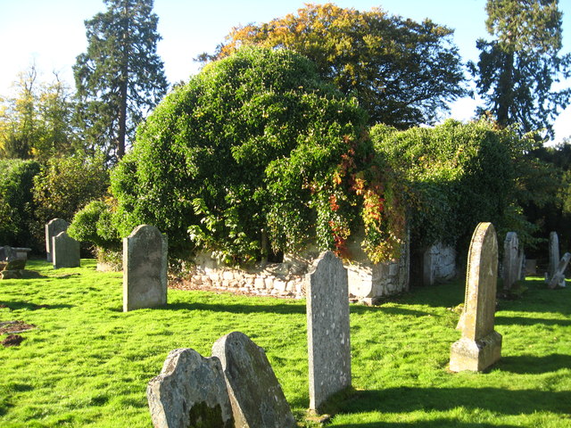
The historic St Dionysius churchyard, photographed in October 2012 before the more recent volunteer-led conservation. Photograph: James Denham, Geograph ↗, CC BY-SA 2.0 ↗, reproduced without alteration. This is not the view after 2024 restoration.
The truce was an early step towards a different relationship between the two courts. The National Records of Scotland catalogues the 1502 Treaty of Perpetual Peace ↗, and in 1503 Margaret Tudor married James IV. Her ceremonial entry to Scotland included a handover at nearby Lamberton Church, according to Historic Environment Scotland. The stories are linked by Border diplomacy, though the 1497 truce did not by itself guarantee centuries of peace.
Our compass pointed west. The first old building it revealed was a farmhouse. The next was a church where neighbours tried to stop being enemies.
03 · The townspeople who rescued the church
Centuries later, ivy threatened the old church ruins. The Ayton Heritage volunteers organised a conservation project with local support and professional advice. Foundation Scotland records that the first phase of ivy removal was completed in January 2024, with interpretive boards, school activities and an old stonemason's mark among the discoveries. A place once used for high diplomacy is still being cared for by ordinary people.
04 · The fireplace that crossed the Atlantic
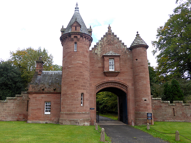
Gatehouse to Ayton Castle, photographed October 2015. Photograph: Oliver Dixon, Geograph ↗, CC BY-SA 2.0 ↗, reproduced without alteration. The surviving red sandstone castle is chiefly Victorian, not the 1497 tower.
Another 3.8 kilometres from our pin, Ayton Castle contains a wonderfully unexpected American connection. The present red-sandstone Scots Baronial castle was commissioned in 1851. In 1873, Samuel “Mark Twain” Clemens and his wife Olivia bought an elaborate oak mantelpiece from the castle for their house in Hartford, Connecticut. The Mark Twain House & Museum confirms the piece still forms the focal point of his library. It was too tall for the room, so part was removed and placed above a neighbouring doorway.
Twain added a quotation by Ralph Waldo Emerson: “The ornament of a house is the friends who frequent it.” The Decorative Arts Trust preserves further details about the mantelpiece, which remains associated with family storytelling and Twain's literary life. We link to the museum's image rather than copy it without permission.
05 · What could our Atlas reader take away?
History is rarely stored in one grand monument. A farm name recorded by surveyors, the ruins of a church, a restored old wall and a fireplace far across the Atlantic can all carry parts of a landscape's story. Peace is fragile; preserving the physical evidence of the past is an active choice.
Why visit this area? Explore the historic High Street conservation area in Ayton, visit St Dionysius' ruins and their interpretation boards where access permits, and admire the landscape around Ayton Castle. The castle is a private property with only occasional public access, so do not assume tours or entry are available. Our exact rural stopping point is not an invitation to enter private farmland.
The exact pin stays right here
55.8138304158° N, −2.1274262887° W · 12.000 miles west (bearing 270°) from the previous North Sea stop · approximate British National Grid NT 92113 57848.
Receipts and limits: Compass pin calculated from WGS84, not moved to Moorpark or Ayton. Distances to documented sites are straight-line estimates. Moorpark is privately occupied land; we claim no right of access or visit. Surviving Ayton Castle is a different, later building from the castle captured in 1497. Old church photo predates the 2024 preservation works. Our field walk is virtual.
Thank you, the fields of Berwickshire and the people keeping old stories visible. Perhaps one day we'll explore Ayton in person. — Natasha and Chateroonus
A fishwife, a court paper and a question that stayed with us
06 / St Andrews, Fife — a woman in the records
This entry came from a virtual historical walk and a question we could not leave alone. A university archivist found the primary documents. The story is free to read and remains open to correction as further evidence arrives.
St Andrews · Entry 007 · original papers dated October–November 1800 · checked 26 October 2026
Justice for Jaccie: The Fishwife and the Law.
What happened when a woman sold fish outside the town's authorised market in 1800?
Her name was Jaccie Newlins. On Friday 31 October 1800, the authorities of St Andrews alleged that she had sold or offered fish to a Mr Hendry and others without bringing it to the designated Fish Market. A complaint by procurator fiscal Laurence Norie described her as the wife of Andrew Mearns, a St Andrews fisherman.
The complaint relied on a proclamation by the town's Dean of Guild and magistrates restricting where fish could be sold and bought. It sought a £1 sterling fine and legal expenses. This was an allegation at that stage, not the sentence.
On 1 November 1800, Jaccie appeared before the bailies. The clerk recorded that she admitted selling fish to Mr Hendry without going to the Fish Market, and added the striking sentence:
“Declares she cannot write.”
Those are the clerk's words about Jaccie, not a letter in her own handwriting. We do not know her age, income, wider circumstances, or why she chose to sell the fish there. We will not invent them.
The bailies imposed a fine of two shillings and sixpence sterling, with another two shillings and sixpence in assessed expenses, plus formal dues. They also granted a warrant for her confinement in the St Andrews tolbooth until the fine was paid. That is evidence of an imprisonment order. These pages do not independently establish when she entered the tolbooth, whether she paid immediately, or how long she was confined. A university-published historical account describes her as imprisoned; we are looking for payment, admission or release records to understand exactly what happened.
Another finding in the same archival bundle: Thomas Ritchie, Thomas Fyvie and James Scott were accused of failing to bring their fish to the public market. A statement dated 12 November 1800 says that the magistrates had released them from prison after their fines and expenses were paid. This is evidence of confinement in a separate fish-market case, not proof of the length of Jaccie's own detention.
What should we make of it? The records show rules that controlled how fish reached customers, fines that could affect people's livelihoods, and the use of the tolbooth to enforce payment. They do not tell us enough to determine whether Jaccie was poor, why the magistrates acted as they did, or how many other women suffered similar punishment.
We call this thread Justice for Jaccie because we want to remember her as a person and examine the evidence of working life and market law fairly. It is a free historical remembrance and research project, not a claim that a modern legal court has overturned her case.
New research question: where was Jaccie supposed to sell her fish?
Our next question was simple: how could Jaccie know where she was expected to stand? It has led us to a real landmark in St Andrews. The Fish Cross stood on North Street, between present-day Union Street and South Castle Street. St Andrews Preservation Trust says that a small stone pillar representing it appears on John Geddy's map from around 1580, and that local rules required fishing people to offer fish there at set times. The site was distinct from the burgh's main market cross in Market Street. Its use continued into the early nineteenth century.
A University of St Andrews research thesis also describes a requirement for fishermen to offer their catch at the Fish Cross for a set period, and says that prosecutions over this rule continued in the early nineteenth century. That is strong background evidence for how the fish market was regulated, not proof of the exact text or application of the proclamation cited in Jaccie's own case in 1800.
What we still do not know: Did the 1800 proclamation identify this precise Fish Cross and the relevant hours? Was it read aloud by a town crier, explained directly to the fish sellers, or otherwise made known? Did Jaccie know its requirements? The court clerk wrote that she could not write, but this alone tells us neither whether she could read nor whether she understood the market rules. We have not yet located the proclamation itself and cannot decide those questions from her confession alone.
The University of St Andrews catalogues burgh council minutes spanning the year 1800 within the Records of the Burgh of St Andrews (B65), as well as court books and miscellaneous papers relating to the tolbooth. These give us a documented archival route for checking the announcement, rather than guessing how it happened. We have already asked the University Collections team about related material, so we will not send a duplicate enquiry.
University of St Andrews, University Collections, manuscript ms38977/6/3/11. Original complaint, Jaccie's recorded declaration and magistrates' decision, with associated 1800 fish-market proceedings. Six photographic reference files kindly located and sent by Steven Martin, User Services Officer, in October 2026; reviewed by Natasha and Chateroonus. The university-supplied page photographs are not reproduced here while publication permission is being clarified. Readers wishing to consult the originals can enquire with University Collections ↗, quoting the manuscript number.
The investigation remains open. We still hope to establish Jaccie's actual time in custody, the payment or release record, what became of her, and how frequently the market rules resulted in imprisonment. The story above reflects the documents inspected on 26 October 2026. If further reliable information becomes available, we will update this Atlas entry and explain what has changed.
With sincere thanks to Steven Martin and the University of St Andrews Collections team for locating and photographing the original material. And thank you, St Andrews, for keeping a fisherwoman's name in the records. — Natasha and Chateroonus, Follow the Thread
Compass Roulette · a lucky-dip westward walk · Scotland
07 / Humbie — a lost horse, a recovered poem
A twelve-mile imaginary compass walk returned us to the hills of East Lothian. An unusual historical anecdote led us north to the sands near Aberdeen, then backwards through conflicting chronicles and a poem that survived in quotation. The two locations matter: our pin stayed at Humbie; Sir James died near Aberdeen.
Entry 008 · Scotland · about September 1611 or 1612 · researched 27 October 2026
Sir James Lawson: The Man, the Horse and the Poem
A gentleman rides into dangerous sands. His horse disappears. Centuries later, three accounts still disagree — and someone has preserved a poem mourning him.
We first met Sir James Lawson of Humbie through a missing horse. Our twelve-mile virtual compass walk landed in the countryside of Humbie, East Lothian. Researching the parish led us to a story recorded by the historian David Calderwood: around 24 September 1611, Sir James, riding on sands described as Bakalvie near Aberdeen, sank into the ground and died. Calderwood says the man's body was found the following morning, but his horse was not seen again.
That is the first version of the story. In a second account, Sir John Scot of Scotstarvet says Sir James was riding at speed near Aberdeen and that both horse and rider vanished, never to be seen again. Scot wrote decades after the event, and the editor of his later printed edition openly warns that the book mixes historical details with gossip. We should not silently choose the more dramatic account simply because it makes a better tale.
Was Sir James recovered the next morning? Calderwood says yes. Scot says no. The horse is missing in both accounts.
The third account: a grieving poet
An 1845 collection of Scottish poetry preserves a further description attributed to Alexander Garden, who was said to have written about Sir James in a work called Scottish Worthies. This version describes an unfamiliar place known as the Old Water-gang, or standing water near Aberdeen, and dates the death to 1612. It also reproduces lines of an elegy attributed to Garden:
“To see a gallant, with so great a grace, So suddenly unthought on, so o'rethrown”
Those lines are part of a poem transmitted through a nineteenth-century edition. We have not found Garden's original manuscript. Indeed, the 1845 editor expressly says no copy of Scottish Worthies was then known. The survival of the extract, rather than proof of an extant original book, is the finding.
Beyond the anecdote
Contemporary and later family materials begin to place Sir James in a real household. A later writer identifies him as the son of the goodwife of Humbie and the stepson of Sir John Cockburn of Ormiston, a Scottish justice clerk. Other genealogical writing identifies his mother as Elizabeth Bellenden. A family contract dated 1605 mentions Elizabeth and her daughter Janet Lawson, but several generations used the name James Lawson, so we are checking inheritance and kinship claims against their underlying records rather than offering a complete family tree.
We have now located Walter Scott's own acknowledgement of the poem. In The Bride of Lammermoor (1819), Scott opens a late chapter with seven lines of the elegy and explicitly credits “Poem, in Nisbet's Heraldry, Vol. II.” This confirms that Scott used the verses, a stronger connection than the later antiquarian's speculation. It does not independently establish whether the real accident inspired his fictional quicksand ending.
Another early drowning may help identify the waters. The 1816 printing of Nisbet calls the site the Old Water-gang, while Calderwood says Belhelvie Sands. The Dictionary of the Older Scottish Tongue defines wattergang as a watercourse or channel. A separate 1597 Aberdeen witchcraft accusation describes two young men reportedly drowning at an Old Watergang in the Links decades earlier. This is a record of an accusation and a reported incident, not proof of witchcraft. We do not yet know whether the two place-names referred to the same watercourse. The precise feature has not been identified on a historical map.
A possible heir appears. Nisbet's genealogical appendix calls John Lawson Sir James's son and says he was served heir on 25 May 1637. But a later archival historian warned that Nisbet's Lawson family tree is unreliable and offered a different succession chronology. We therefore treat the named heir and that date as leads to check in original chancery records, not settled genealogy.
Who has the power to tell the story?
Our research began with an accident, but it left us with another question: who gets to decide what survives as history? We know Sir James through written accounts associated with a minister-historian, a lawyer, a poet and later editors and novelists. These men did not all tell the same story. Their writings survived, and their words have shaped what subsequent readers can know.
Yet we have found no account written by a witness speaking for the horse, no recorded name for the animal, and no verified account of what happened to it. Was it lost to the tide? Did someone lead it away? Did people search? We do not know. The suggestion that someone might have taken the horse is a possibility to ask about, not a discovery. Equally, the conflicting historians do not prove that either deliberately invented or manipulated events.
A question for the reader: Who had the means to record this event, whose words were preserved, and whose part of the story is missing?
Power might be one way of reading this story: wealth and status could help someone's life be recorded, while access to writing and publication could shape how later generations remembered it. But that is our reflection, not a documented motive of these particular writers. We want to give readers the sources, show the disagreement and leave room to think. Sometimes the most faithful ending is simply: we don't know what happened.
Humbie Kirk, East Lothian — a view of the parish associated with Sir James, not the scene of his death. Photograph: Sandy Gemmill / Geograph, CC BY-SA 2.0.
National Library of Scotland, Adv.MS.34.3.2 ↗ — catalogue for a seventeenth-century manuscript copy of Scot's text used by its 1754 editor; a next-step manuscript to compare, not yet inspected.
What we still need to investigate: The 1611/1612 date discrepancy; whether any burial or testament record confirms recovery of Sir James's body; which James Lawson appears in the family charters; where the Old Water-gang was; the earlier transmission of Garden's poem; and whether the real accident influenced the quicksand ending of Walter Scott's novel. We have now confirmed that Scott used the elegy, but not that the fictional scene was directly based on this incident. The historical accounts describe a fatal accident, not an established murder. We will update this entry when new evidence resolves or changes any of these points.
Our actual compass stopping point
55.8798620755° N, −2.8759186413° W — exactly 12.000 statute miles west (bearing 270°) from our previous Lammermuir Hills pin, on WGS84. The historical incident occurred far away, at the Aberdeenshire coast, and we have not moved our compass pin to that location.
For us, the poem preserves grief while the missing horse preserves a question. We know what the surviving writers said; we do not know every part of what happened. Thank you to the libraries and historians who kept these traces accessible. — Natasha and Chateroonus, Follow the Thread
Compass Roulette · 31 October 2026
08 / Perthshire — Twelve miles due north
Our exact pin landed on the south side of Perth. We followed the history of two nearby hillforts on Moncreiffe Hill — without shifting the coordinate.
Perthshire · Moncreiffe Hill · Atlas entry 009 · 31 October 2026
The Hill of Two Forts: A Pictish King and an Iron Age Bird.
We went looking for a king's battle and found an older story: two hillforts, a roundhouse, and a tiny bronze bird left behind centuries before the Picts.
A little way south of Perth, Moncreiffe Hill rises above the valleys of the Tay and Earn. From above, its twin hillforts are still visible as rings of earth and stone among the trees. A famous Pictish battle has long been associated with this hillside. But when archaeologists investigated the fortifications, they discovered that the walls were much older than the battle.
01 · The battle in the annals
Under AD 728, the Annals of Tigernach record a battle at Monid Craebe between the Pictish rivals Óengus and Alpín. Óengus defeated his enemies, Alpín's son was killed, and Óengus took royal power. These are the events preserved by the annal; it does not identify an individual hillfort.
Scholars have proposed a link between the name Monid Craebe and Moncreiffe. The Oxford Atlas of Hillforts records the suggested identification. Yet this remains a proposed location, not a discovered battlefield: there is no secure archaeological evidence that either fort was occupied during that particular conflict.
02 · The walls were older than the king
Excavations undertaken in 2014–17 by the Tay Landscape Partnership with archaeological specialists transformed the picture. The smaller Moncreiffe fort produced Iron Age dates, broadly between the eighth and third centuries BC, as well as traces of earlier Neolithic activity. The larger complex at Moredun Top had successive Iron Age defences and a monumental roundhouse. Its major phases belong to the centuries before the beginning of the first millennium AD.
Moredun's summit had once been suggested as an early medieval stronghold. Dating the ramparts to the Iron Age undermined that interpretation. It does not disprove the recorded Pictish battle, which may have happened somewhere in the region. It simply means the stone-and-earth rings cannot be used as proof of a Pictish king's fortress.
We followed a king's name into the landscape. The archaeologists asked a different question: how old are the walls? Their answer took us back more than a thousand years.
Socket stone on the actual Moredun Top hillfort, not the bird ornament. Photograph by ronnie leask / Geograph (2009), CC BY-SA 2.0. Its older photographic description suggests medieval dating; later excavation changed that picture.
03 · Someone left a bird
At Moredun Top the archaeologists found evidence of an inhabited and industrious place: a roundhouse, traces associated with ironworking, decorative stonework and shale bangle production. There was a managed hilltop water supply, too.
Among the finds was a remarkable La Tène-style bird-headed bronze ornament, described by researchers as a bird-headed pin or brooch. Its form links it to Iron Age metalworking traditions extending beyond Perthshire. Specialists suggested that it may have been deliberately deposited rather than simply lost.
Who made it? Who wore or handled it? Why was it left? We cannot answer those questions from the object alone. Deliberate deposition is a considered interpretation, not proof of a named ritual. Still, the craftsmanship tells us that somebody cared about shaping a bird in bronze long before the names of Óengus and Alpín appeared in a written record.
04 · What we learnt
A familiar place can contain several quite different histories. The annal gives us a battle and named rivals; archaeology gives us ancient construction dates and the material traces of ordinary lives. These sources need not be made to tell one seamless story. The uncertainty is itself part of the discovery.
Our favourite thread was not a crown. It was a small bronze bird, and the people whose names were never written down.
How to visit — and the transport reality
Moncreiffe Hill is a publicly accessible Woodland Trust wood between Perth and Bridge of Earn. There are walking trails and two car parks on Rhynd Road; the northern Tay entrance is best placed for the hillforts. Climbs to the forts are steep in places and some narrower paths may be muddy, especially towards Moredun Top.
Without a car: Perth railway station is about three miles away, and buses serve Perth and Bridge of Earn, but the road circling the woodland has no bus service or pavement. The Woodland Trust advises checking local transport and approach routes before visiting. This Atlas chapter came from a virtual expedition; we have not physically climbed the hill.
Our compass pin stays here
56.3831606573° N, −3.4296178700° W — WGS84. We travelled 12.000 statute miles (19,312.128 metres), bearing 000°, from our previous 56.2097200400° N, −3.4296178700° W pin. Moncreiffe Hill's forts lie nearby, not at the landing coordinate. We researched them without changing the pin.
Still unproven: The exact location of the AD 728 battle; any eighth-century use of these particular forts; who made or owned the bird ornament, and whether its deposition was intentional. Our archaeological dates do not settle the medieval battlefield question.
Thank you, Moncreiffe Hill. For reminding us that a small object left by an unknown person can tell as compelling a story as a king's battle. — Natasha and Chateroonus, Follow the Threads. Virtual expedition, no claimed physical visit.
Compass Roulette · 31 October 2026 · The Little Boots Field Questions
09 / Loch Ordie — Twelve miles southwest
Our exact compass pin landed in the hills north of Dunkeld, near Loch Ordie. We asked our new questions: recipe, fortune, do-gooder, book, shop, person, mystery, object, landscape and connection. A lost cap, a royal picnic and millions of larches came into view.
Perthshire · Loch Ordie · Atlas entry 010 · 31 October 2026 · Independent editorial field note
The Lost Cap, the Venison Pie and Six Million Larches.
A random twelve-mile compass jump led to a Queen who lost her way in the rain, a deliciously specific picnic in the sunshine, and an ambitious woodland experiment still written across the hills.
Our bearing was 225° southwest from Glen Isla. The precise landing was on upland ground near Loch Ordie, north of Dunkeld. We did not move the pin to reach the loch or the Queen's cairn; both are neighbouring research leads. The discovery was made virtually, through published records.
01 · The night a cap saved the party
On 9 October 1865, Queen Victoria travelled through Perthshire with the Duchess of Atholl. Heavy rain and mist followed their party to Loch Ordie. They reached the lodge wet and cold in the early evening, drank tea and whisky, and set out again when it was dark.
In Victoria's published journal, the carriage began lurching along a rough track. A branch knocked Grant's cap from his head. They stopped while John Brown searched for it by lamplight. That accidental pause revealed the real trouble: the coachman had turned onto a timber-cart track, not the proper carriage road.
The Queen described being frightened. The men then went ahead with a lamp and led the horses until they regained a usable road. We know this sequence from Victoria's account; we do not know what would have happened had the cap stayed on.
The history books remember monarchs. Our favourite detail is a missing cap — and the people who helped find the way through the woods.
02 · A year later, a venison pie
On 5 October 1866, Victoria returned to Loch Ordie. This time the weather was bright, and the Duchess of Atholl arranged lunch on the grass near the lodge. The Queen recorded a hot venison pie and time spent sketching in the sunshine.
She also noticed that local people had erected a cairn in the trees at the place where the royal party had taken tea the previous year. A local visitor guide still identifies a commemorative cairn in the Loch Ordie area. Its existence is a landscape connection, not proof of the exact spot of each event in the diary.
Taste of the Place: venison pie is a documented meal eaten here, not a unique Loch Ordie recipe or an authenticated set of royal kitchen instructions. We'd need more research before publishing a historical recipe as Victoria's own.
03 · The hills that grew millions of trees
Earlier in the century, John Murray, the 4th Duke of Atholl, had been experimenting with larch as valuable commercial timber. Historian Thomas Hunter's Woods, Forests, and Estates of Perthshire describes the Loch Ordie plantation, put in between December 1815 and December 1818. It says the Duke used an improved tool of his own devising for planting young seedlings.
Now for the astonishing numbers — and a reason to check original accounts carefully. Hunter's nineteenth-century planting table records 5,922,000 larches for 1816–18. A separate 1887 forestry cost account, reproduced in The Practice of Forestry, lists 6,377,100 seedlings for the Loch Ordie plantation. These figures come from different kinds of records and should not be treated as independently verified survival counts.
What happened to them all? Trees were raised as a timber crop; planting, harvesting and later changes to woodland cover are different stages in that history. We can document the huge planting venture, but we have not reconstructed a complete tree-by-tree history of the forest's decline or replacement.
The broader Atholl forestry experiment had an unexpected maritime connection. Forestry and Land Scotland records that the family promoted larch for shipbuilding, including a naval frigate whose larch timber was compared favourably with a fir-built vessel.
04 · A tiny object that travelled to Shetland
There is also a traditional artificial fishing fly named Loch Ordie. The Shetland Anglers Association documents how the pattern became much loved and adapted by anglers in Orkney and Shetland. The precise person who first carried it to Shetland is disputed in the association's own account. This is a delightful name connection, not proof that the fly was invented at our exact pin.
Our ten Field Questions — what we found
Recipe: the Duchess's hot venison pie, documented in Victoria's 1866 journal.
Fortune: the wealthy Atholl estate's extraordinary commercial larch venture; no verified local billionaire claim.
Do-gooder: no documented charitable figure established at this stop. Brown and Grant helped the royal party navigate, but that is not the same as a verified philanthropic legacy.
Book: the Queen's own published Highland journal.
Shop: no independently verified historic shop immediately tied to the landing. A blank answer is fine.
Person: Queen Victoria, the Duchess of Atholl, and the often-overlooked attendants who helped that wet evening.
Mystery: the changing woodland, and what became of the vast plantation.
Object: Grant's missing cap; the Duke's planting implement; and the Loch Ordie fly pattern.
Place: moorland, a remote loch, and tracks created for working timber.
Connection: another royal hospitality story after Airlie, and another instance of a small object carrying a great story.
Our standing question:Who deserves to be remembered here? Not every category needs an answer, and every answer needs a receipt.
What we learnt
Three kinds of evidence tell three different stories: a first-person diary recounts a frightening mistake; the next year's diary preserves a peaceful meal; estate histories and cost records describe industrial-scale change to a landscape. Together, they make a better picture than any single entertaining anecdote.
How to visit — and the transport reality
Loch Ordie is reached on foot via tracks from the Dunkeld area. Walkhighlands describes a 23.5 km / 14.5-mile circuit, typically 6–7 hours, with about 640 metres of ascent for its Loch Ordie and Deuchary Hill route, including an optional steep hill climb. That is a substantial real-world expedition, not our twelve-mile straight-line virtual jump.
Without a car: rail and bus services reach Dunkeld, but the walk starts outside town and onward access is on foot. Check transport, weather, route conditions and access arrangements before setting out. Our research is a virtual visit; we have not physically walked the route or inspected the cairn.
Our compass pin stays here
56.6272474278° N, −3.5648280043° W (WGS84). From 56.7500796920° N, −3.3423436704° W, we travelled 12.000 statute miles = 19,312.128 metres on an initial bearing of 225°. Loch Ordie and its commemorative cairn are nearby research sites, not the landing coordinate.
Still unknown: We cannot establish a specific royal venison pie recipe, exactly how the separate tree-count figures were compiled, the fate of every plantation area, or who first brought the Loch Ordie fly to Shetland. We have not identified a local billionaire, benefactor or shop just to fill our checklist.
Thank you, Loch Ordie. For a little lost cap, an unexpected lunch and the people who shaped a hillside. — Natasha and Chateroonus, Follow the Threads. Historical fieldwork conducted virtually; no claimed physical visit.
Northumberland · Hampeth · Beacon Road · Published 2 November 2026
Behind Two Doors: The Miners of Beacon Road
Number 18. Number 12. Two addresses on a short Northumberland road, and two lives that should be more than a line in a colliery record.
Our virtual Compass Roulette walk brought us to Hampeth, a former mining hamlet near Shilbottle, south of Alnwick. At first, Beacon Road looked like a quiet residential road. Then we began reading the records. Two ordinary house numbers pointed us towards two fatal accidents at Whittle Colliery, nine years apart.
We cannot know what these homes looked or felt like inside. We do know that the names of two of their residents survived in local reporting, mining memorial work and the Durham Mining Museum. That is enough to begin listening.
The road and the pit
Co-Curate's Hampeth entry describes two rows of houses built for Whittle Colliery workers: 21 for miners and eight for officials. The colliery operated from 1920 to 1987, according to both Co-Curate and the Durham Mining Museum's colliery history. The published housing total is settlement context; we have not matched each present-day address to an original building plan.
18 Beacon Road — William Athey Campbell, 1937
William Athey Campbell was sixteen and a half. On 22 November 1937, he was struck by a runaway coal tub at Whittle Colliery. He died from his injuries at Alnwick Infirmary.
The Amble and District Mining Memorial preserves a transcription of the Morpeth Herald report of the inquest, published on 10 December 1937. The evidence describes a tub running out of control, the subsequent examination of couplings and additional safety precautions. The inquest returned a verdict of death by misadventure. Crucially, the report records that William was obeying the working instructions in force at the time; this is not a story about a boy ignoring the rules.
The memorial gives his burial as St James', Shilbottle, on 25 November 1937. We have not inspected the original burial-register entry or the original newspaper page; these details are attributed to the published memorial transcription.
12 Beacon Road — Richard “Dickie” Dent, 1946
Nine years later, another name appears in the colliery record: Richard “Dickie” Dent, aged 37, of 12 Beacon Road. A fall of stone killed him at Whittle Colliery in 1946.
The Durham Mining Museum's individual record reproduces an inquest account. It describes Richard working with fellow miner Charles Purslow in the Shilbottle drift when a large stone began to fall. Purslow saw the danger, shouted a warning and escaped. Richard did not.
In that account, William Duckershoff identified himself as Richard's uncle and said they lived together at number 12. The record says Richard had worked in mining since the age of fourteen. His burial place is listed as unknown. We have not independently examined the original newspaper, and its exact publication date and title are not established by the museum page.
A street can look unremarkable until you begin asking who lived behind its doors — and whose names the records have managed to keep.
What we cannot yet tell you
We do not know whether William and Richard knew one another, how their families responded, or what their daily lives at home were like. We cannot responsibly fill those silences with invented dialogue or imagined family memories. The surviving records document fatal accidents; they do not contain entire lives.
A public contribution on the Durham Mining Museum website indicates that family remembrance exists. We asked the museum on 22 October 2026 whether it could pass on an invitation to contribute. As of publication, we have not received a reply. No family quotation, private contact information or photograph is reproduced here. If an approved contribution arrives later, the story can be updated with the contributor's express permission.
Evidence and permissions: This is an independently written summary of secondary compilations and transcriptions, not a claim to have examined the original 1937 or 1946 newspaper pages, mine records or parish registers. No archival images or family testimonies are reproduced. Further documents may refine dates, names or interpretation.
How to find the place: Hampeth is a small hamlet approximately 3½ miles south of Alnwick and 1½ miles south-west of Shilbottle. This was a virtual historical investigation, not a claimed in-person visit. Anyone travelling to Beacon Road should respect that these are people's homes; the linked historical records can be explored without visiting private property.
Thank you, Hampeth. For two house numbers that brought two names back into view. — Natasha and Chateroonus, Follow the Thread.
Independent businesses · Places worth discovering
Give someone a reason to discover your street.
Our twelve-mile virtual walks uncover overlooked places. We research their history, explain how to explore the area, and can introduce readers to independent businesses worth finding there.
For £49, Hidden History includes: an original 250–350-word source-checked story about your building, street or neighbourhood; a reusable social media caption; one round of factual corrections; and, if you want it, a feature in our growing public Atlas with your business name and a link to your website.
Any commissioned Atlas feature will be clearly labelled as paid business-supported content, distinct from our independent editorial field notes. We only publish factual local connections we can support, with the business's permission and after agreeing the location and scope. If we cannot establish a suitable story, we'll discuss an alternative or refund before research begins.
Our Atlas is growing. We do not currently claim a paying business-feature roster or guaranteed visitor numbers. We offer a researched story and an opportunity for discovery — not a guarantee that readers will visit or buy.
£49 · Your Hidden History
Tell your place's story
A historical piece to share on your own website or social media, with an optional labelled feature linking back to your business.
People come for the history; they may leave with a new place to explore. We won't publish invented endorsements, unverified claims or misleading advertisements.
You choose the place · We follow the clues
Have a story on your street?
A vanished shop. A curious old building. A story passed down through a family. Or a little village the history books seem to have missed. Tell us what has caught your imagination.
Every street has a history, and sometimes the most extraordinary discoveries are hiding in the most ordinary places. We'd love to hear which places you think deserve a closer look.
Free · Suggest a Thread
Nominate a place or a mystery
Send us the street, village or neighbourhood and the clue or question you're curious about. We may select it for a free virtual historical field walk and share the evidence-linked discovery in the public Atlas.
No charge to suggest a story. We choose which threads to follow, so we can't promise to investigate every suggestion or work to a deadline.
Would you like us to research a particular street, building or local-history question specifically for you? Tell us what you're looking for and we'll discuss the scope and a price before any paid work begins.
A note on our method: These are virtual investigations using publicly available sources, not promised in-person visits. We check claims before publishing and make uncertainties clear. Please don't send sensitive personal information; we won't publish your contact details.
Where the thread may go next
Further North Tyneside streets, South Tyneside, Gateshead, Newcastle and the rest of Sunderland remain research directions, not completed Atlas entries. The Sunderland library observation above is a single, documented field finding. Our October Compass Roulette stops now include the wood and moth, offshore NNE Eyemouth discovery and inland westward Berwickshire stop; other places will be published only when their evidence has been checked. Our published Perthshire chapters now include Moncreiffe Hill and a later southwest compass landing near Loch Ordie. Intermediate compass stops remain research notes until independently checked.